Journey of discovery

It’s about the perception and challenges of space and the orders in which we live.

21.01.2021

Interview with Till Krause

Your map is almost 20 years old: What would probably be different today?

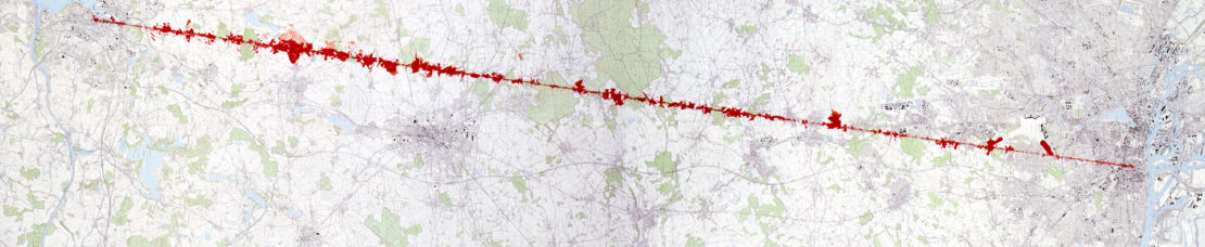
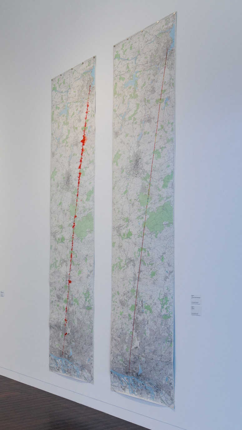
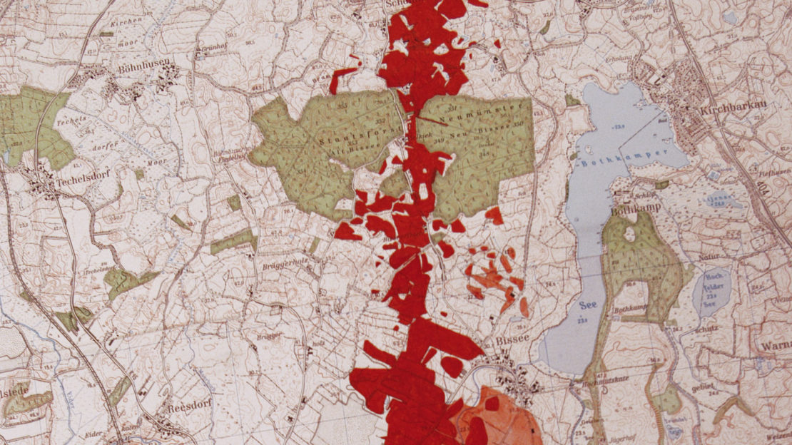
20 years probably plays a lesser role for changes than short-term changes, such as the different times of day, weather conditions and seasons. After all, the perception of space for us humans is completely different at night than during the day, different in fog than in clear air. And in winter, when the fields are fallow and trees are bare, a landscape has a different shape than during the times when everything is growing. The records for the maps of total straight-line walking were subject to different conditions early in the morning than in the evening. And since walking in a straight line in the local landscape is extremely slow, a maximum of a few kilometers per day, much less in built-up areas, the traversal was stretched over different seasons. In the maps, therefore, snapshots and inadequacies are mixed with efforts to achieve objective accuracy. That is the interesting thing about reading maps: they are not “right”, but they live from the difference to what they are about. And this difference must be filled with one’s own interpretation and imagination when reading the map. Only through this the map does take shape. It is often claimed that cartography strives for a 1:1 relationship to its subject. In my opinion, it’s the opposite. The cartographic approach is basically about difference.

Of course, a lot has changed in the 20 years. In and around towns and villages, many previously open areas were built on. And at that time, some corn fields were already on the way, but since then, corn cultivation as a source of energy and fodder has increased extremely in Germany and creates huge block formations in space in certain months. Such developments affect all the different maps that have been created of the crossing, especially the Blickfeldkarte. And there’s even an effect on the Handykarte. Try making a phone call in the middle of a tall cornfield. Because of the development of mobile communications, one would like to assume that the Handykarte would have to be drawn differently than it was back then. But to see whether this is really true requires a closer look. It is possible that the differences are not that significant. By and large, the maps of that time should also apply to today’s space, because today the same basic rules still apply to this space. If, on the other hand, the ideas of land ownership and the industrial exploitation of soil, water, plants and animals had been dissolved, for example, the maps would look completely different.

© Till Krause, photo: Carl Brunn

You are from Hamburg. Why did you choose Kiel as the starting point of your journey?

It could have been any other place to test space. The occasion at the time was the curator Enja Wonneberger’s invitation to her exhibition Changes Possible, which took place outdoors in downtown Kiel. I set out from that exhibition space. I chose the Galerie für Landschaftskunst in Hamburg as my destination point, because the office for many of our outdoor space projects is located there. The maps of the crossing were then shown at the Kunsthalle zu Kiel in the middle of the department for 19th and 20th century landscape painting.

Do you like to take detours?

It’s not about what I like to do, but about the perception and challenges of space and the orders in which we live. Going straight is a possible figure for this, as is, for example, taking-detours or do-not-let-the car-get-below-200 or eat-up-a-city…

Biography

  • * 1965 in Hamburg
  • since 1992 work with the artist-project space Gallery for Landscape Art
  • Lives and works in Hamburg